

Re your Dec. 9 column on the scope expansion the Planning Department has undertaken with the Main Street East study we would agree, the direction taken by Planning is totally unwarranted for a number of reasons.
When Save Main Street and the Historic Society proposed Town Council consider a Heritage district be considered to help provide property owners of Main St East with the best protection against unreasonable development not in keeping with the historic streetscape, the boundaries we recommended were very specific for a few key reasons:
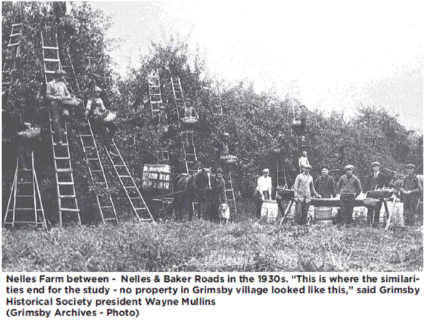
Main Street East between Robinson & the Beamsville / Lincoln boundary represents the growth area that happened in North Grimsby Township along the No.8 highway in the late 1800’s / early 1900’s. This came as a result of the Hamilton Grimsby Electric streetcar railway (HG&B) and the services the HG&B provided directly to farmers that enabled them to prosper.
The late 1800’s expansion of Main Street East occurred under North Grimsby Township rules (not Grimsby village rules as Main St E. did not come under Grimsby control until the creation of Niagara Region in 1969 / 70). North Grimsby developed Highway 8 / Main St East with a much more refined set of guidelines that resulted in properties with a more formal character, quite different from those in Grimsby village:
• deep building setbacks from the roadway
• landscape buffers between properties
•limited building density and lot coverage, and;
• large lawns and intensive garden like plantings on most every property.
The farm properties along Main St East added significantly to crop production in the area as they matured, giving rise to the “Garden of Canada” nomenclature that Main St East and Main St West farm sections came to be known as. This had little to nothing to do with Grimsby village properties that Planning has now wrapped into an expanded study area.
When this study was first proposed, Planning Dept. was pushing to limit the scope to the area between Robinson and Nelles Road / the Hospital. Planning maintained, to go beyond the hospital, would make the study area too large. We resisted that position – the Garden of Canada did not stop at the hospital on Main Street East! The approximately 200 properties from Robinson to the Lincoln border to be studied were well within the range of numerous other existing heritage districts across Ontario.
Now the “heritage professionals” of the Planning Dept. expanded the scope from a reasonable 200 properties, which they are on record as not wanting to do, to a crushing 800 including the downtown business section and much of the old Grimsby village.
Why this makes no sense:
The scope has become so expansive it limits what the consulting firm can reasonably assess with the project budget they have been given. By making them evaluate the Commercial core and other areas of old Grimsby Village, it dilutes the consultants’ ability to effectively evaluate the true heritage values of Main St East, which is what was being asked for. Perhaps that’s Planning’s intent, by diluting the study area it renders the study unreasonable and they won’t have to deal with the downstream work associated with a possible heritage District.
The inclusion of the Downtown commercial district: Mixing historic residential farm areas of Main St East with the commercial core is nonsensical.
Historical designations for downtown commercial districts should only be considered as part of a proper downtown master plan done separately in conjunction with business owners and the DIA to find an appropriate balance between economic development opportunities and the protection and/ or enhancement of the historic character of the downtown. That is clearly a significantly different piece of work!
Grimsby’s Official Plan recognizes the differences between the East / West corridors of Main Street versus downtown. It provides for additional streetscape design elements outside of downtown and mandates larger setbacks there while for the Downtown area it clearly states in 3.5.2 that all considerations for designation or change in the Downtown will be done in hand with the DIA. Clearly the Planning staff by-passed Town policy when they expanded the Main Street East study scope without any consultation.
The expansion of the study boundaries has extended its reach into distinctive elements of local history of Grimsby village & the Downtown that should each be considered on their own merits as they have NOTHING to do with considerations of Main St East as a heritage district:
• Main Street East – large 1890s-1900s prosperous farms/ Garden of Canada era outside of Village of Grimsby political control.
• Downtown Business district – this study mixes core commercial with unique residential sections
•Oak / Elm / Mountain Streets – 1860’s-1870s Grimsby village area developed with the Palmer Grout foundries manufacturing agricultural implements
•Ontario / Depot Street / Adelaide neighborhoods – developed 1850s around the arrival of railway service.
The Railway – to justify including the Ontario Street district, Planning’s rationalization was that Main St East farmers used the Railway station, a justification that you rightly discredited. Their rationale is actually built on material misinformation.
Yes, some farmers of Main Street East used the GTR village station but mostly indirectly if they had sold their produce to packers/shippers such as Niagara Packers who operated out of Grimsby’s railway station.
Main Street East farms actually used other facilities which helped improve their service and profitability.
They shipped fruit directly twice a day from nearby Grimsby Beach via steamers to Toronto markets.
HG&B electric railway was their core service.
They shipped on the HG&B electric railway directly to markets in Hamilton & the CPR in Hamilton who had direct connections with national customers.
The HG&B picked up directly at each farm’s shipping platform as much as four times a day. All the farmer had to do was get the produce to his roadside platform for pickup; the HG&B freight conductors loaded and handled it from there.
The HG&B partnered with the CPR to put air conditioned / ventilated freight cars on the electric railway route. This service took their product to Hamilton or area canners and packers such as the cannery on Robinson, on Livingston, E.D. Smith’s in Winona or Smith’s Beamsville cannery.
Railway service – Main St East farmers needing rail service had no need to go to the Village GTR station. The GTR station at Park Road/Grimsby Beach station was much closer for most. Initially produce was picked up on the station platform there, then a 1/2 mile long siding was expressly built by the GTR at Park Road for handling Grimsby east fruit.
What has being manifested with this study is most of the Planning Dept staff are non-Grimsby residents with little to no practical knowledge of Grimsby’s history yet they try to flex their “professional” heritage designations to infer they know what is best without considering the true background history or wishes of the community at large.
(Editor’s Note: The above was submitted by Wayne Mullins, President of the Grimsby Historical Society)